On March 17, 2025, the Utah Department of Transportation (UDOT) issued a Road Weather Alert due to an incoming cold front. This weather event is set to impact travel across northern and southern Utah, raising concerns for drivers on major highways.
- Road Weather Alert issued for Utah
- Cold front arrives Monday evening
- Heavy snow expected in mountain routes
- Slushy roads anticipated Tuesday morning
- Gusty winds of 40-50+ mph forecasted
- Caution advised for affected travel routes
Are you ready for the snowy conditions ahead? With cooler temperatures expected, it’s crucial for motorists to stay informed and cautious.
Cold Front Brings Snow and Travel Challenges Across Utah
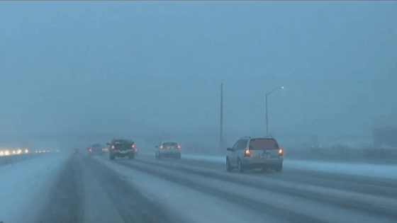
As the cold front moves in on Monday evening, many Utah residents are left wondering how it will affect their evening commute. With snow anticipated through Tuesday morning, travel could become hazardous on major routes. Are you prepared for winter driving conditions?
Key Routes Affected by Snow and Icy Conditions
UDOT warns that several major highways will experience significant weather-related travel concerns. Drivers should be especially cautious on the following routes:
- I-15 from the Idaho border to Cedar City
- I-80 from Grassy Hill to the Wyoming border
- I-215 along its entire route
- US-40 over Daniels Summit
Snow Accumulation and Wind Gusts Expected
In addition to snow, gusty winds of 40-50 mph are expected, particularly affecting southern Utah. This could lead to drifting snow, especially near Brian Head and Upper SR-14. Motorists should be prepared for rapidly changing conditions.
Mountain Routes Anticipate Heavy Snowfall
Mountain routes, including Cottonwood Canyons and Logan Summit, are projected to receive several inches of snow. Heavy snowfall could lead to treacherous driving conditions, making it essential for travelers to plan ahead and drive cautiously.
Stay Informed and Travel Wise
As the weather unfolds, UDOT will continue to provide updates on road conditions. Staying informed is key to ensuring your safety while traveling. Are you ready to take on the winter weather?