Belgium’s weather has taken a sharp turn as the summer warmth that delighted many is now coming to an abrupt end. On Friday, May 2nd, 2025, Ukkel matched a day record from 1986 by reaching 26.7 degrees Celsius, marking a rare heat spike for early May. However, this fleeting summer-like weather is set to give way to much cooler and wetter conditions.
- Zomerweer eindigt met recordtemperatuur in Ukkel
- Temperatuur daalt meer dan tien graden binnenkort
- Kans op zware regen en onweer zuidelijk
- Code geel voor overvloedige neerslag zaterdag-zondag
- Maxima tussen 10 en 23 graden variëren regionaal
- Wisselvallig weer met enkele buitjes verwacht maandag-woensdag
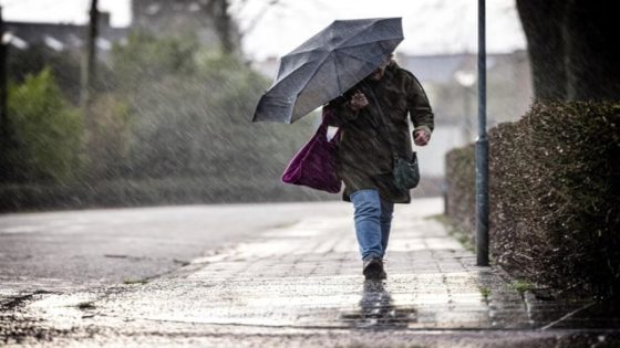
Starting Saturday, clouds will roll in, especially over southern Belgium, bringing thunderstorms and heavy rain. Temperatures will drop dramatically, with Sunday’s highs falling to between 10 and 15 degrees Celsius. This sudden change raises the question: how will Belgians adapt to such a swift weather shift after a week of unusually warm days?
As the forecast evolves, it’s important to stay informed about the expected weather changes and their impact on daily life. Let’s explore what this means for the coming days and beyond.
Why is this sudden weather shift significant? It highlights the volatility of spring weather in Belgium and the need for preparedness. Key points to consider include:
- The heat record matched on May 2 reflects unusual warmth for this time of year.
- Saturday’s thunderstorms and heavy rain will mainly affect southern regions, prompting a yellow weather alert.
- Temperatures will drop by more than 10 degrees, with coastal areas remaining coolest.
- Early May’s weather swings raise questions about climate variability and its effects on outdoor plans and tourism.
Looking ahead, staying updated on weather forecasts will be essential as conditions remain changeable into midweek. Will this cool spell persist, or can Belgians expect another warm-up soon? For now, it’s wise to prepare for cooler, wetter days and adjust plans accordingly.