Ex-Tropical Storm Alvin is bringing unusual moisture to the Southwest U.S., enhancing rainfall patterns that are typically dry this time of year. As of June 1, 2025, this moisture will also fuel storms in the central U.S., creating a dynamic weather scenario.
- Ex-Tropical Storm Alvin brings moisture to Southwest.
- Unusual rainfall expected for late May.
- Flash flooding possible in southern Arizona.
- Severe thunderstorms likely in Central Plains.
- Damaging winds and hail are main threats.
- Forecast updates will be provided regularly.
The remnant moisture from Alvin will result in showers and thunderstorms across the Southwest, including cities like Phoenix and Tucson, through Monday. This unexpected rainfall could lower temperatures by up to 15 degrees, providing a brief respite from the heat.
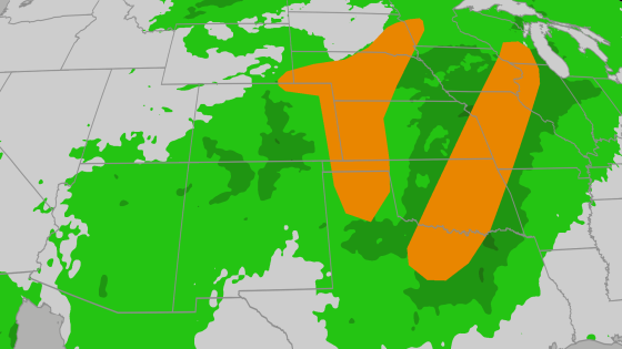
What does this mean for residents? The influx of moisture from Alvin raises concerns about localized flash flooding and severe weather across several states. Key points to consider include:
- Up to an inch of rain expected in the Four Corners region.
- Severe thunderstorms likely from Texas to Minnesota, with damaging winds and hail as primary threats.
- Storms will continue to develop into Tuesday, affecting areas as far north as Michigan.
As we navigate this unusual weather pattern, it’s crucial to stay updated on forecasts and take necessary precautions. Will you be ready for the storms ahead?