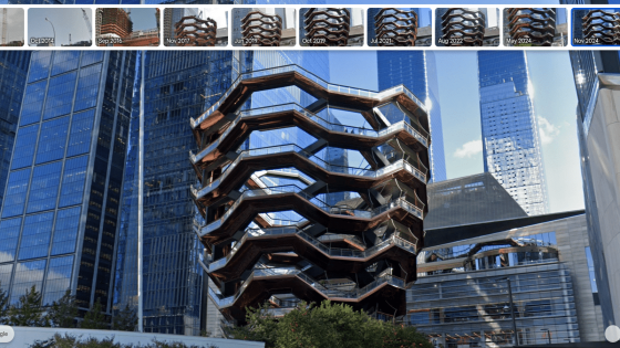
Google Earth is making waves with its latest update, allowing users to explore historical imagery from Street View. This exciting feature, launched in celebration of the tool’s 20th anniversary, enables users to witness how locations have transformed over the years.
- Google Earth adds historical Street View imagery.
- Tool celebrates its 20th anniversary.
- Users can view images from different years.
- AI-driven insights for professional users coming.
- New features include tree canopy coverage data.
- Access to land surface temperatures planned.
Previously, Google Earth users could switch to Street View while viewing satellite images, but now they can delve into images captured across various years—similar to the functionality available in Google Maps. As of 2025-06-24 16:00:00, this update enhances the user experience significantly.
This update raises an intriguing question: how will this feature influence our understanding of climate change and urban development? By providing a visual timeline, users can better grasp the impact of human activity on the planet.
- Enhances environmental awareness on a global scale.
- Supports urban planning and development strategies.
- Encourages educational initiatives around climate change.
- Facilitates research in various scientific fields.
As Google Earth continues to innovate, users are encouraged to explore these new features and consider how they can contribute to a more sustainable future.


