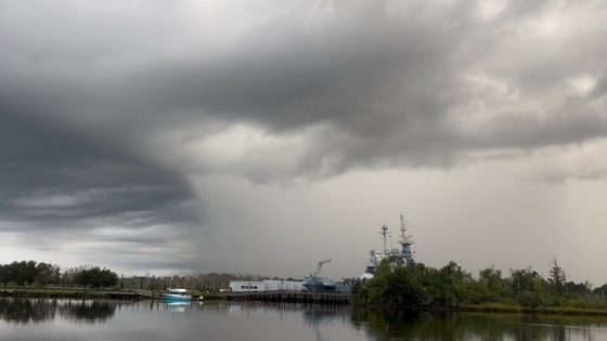
The Southeast is bracing for tropical downpours as heavy rain begins to impact the Carolinas. With NOAA’s Weather Prediction Center issuing a Level 2 out of 4 flash flood risk, residents are urged to stay alert. As of 2025-08-01 16:07:00, a powerful cold front is moving southward, threatening to disrupt summer plans along popular beaches.
- Tropical downpours affecting the Carolinas.
- Level 2 flash flood risk issued by NOAA.
- Cold front causing prolonged wet weather.
- Potential for tropical development remains low.
- Rainfall totals could reach 3-5 inches.
- Flooding threat decreases into next week.
This weather system is expected to linger, raising concerns about flash flooding and potential tropical development along the Southeast coast. Meteorologists warn that rainfall totals could reach 2–3 inches, with isolated areas seeing up to 5 inches.
The implications of this weather pattern are significant. With a history of flooding in the region, many are left wondering how this will affect local communities and businesses. Key points to consider include:
- Flash flood risks are highest in coastal areas like Charleston and Savannah.
- Heavy rain could disrupt weekend plans for beachgoers.
- Potential tropical development remains a concern, though chances are low.
- Flooding has been a recurring issue in the Southeast this summer.