Belgium is experiencing the final day of an intense summer heatwave, with temperatures set to drop sharply from tomorrow. As of 2025-07-20 02:55:00, weather forecasts indicate that from Monday until the end of July, daytime highs will no longer exceed 25 degrees Celsius.
- Temperatures drop below 25 degrees soon
- Thunderstorms may develop near Limburg region
- Monitor radar frequently for weather updates
- Radar predictions have limited accuracy
- Storm intensity and path can change rapidly
- Thunderstorm risk ends late evening today
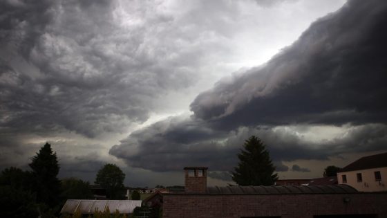
Will the cooler weather bring relief or unexpected challenges? This transition period may also trigger thunderstorms, especially near Limburg, where clouds are already developing into showers. Understanding these changes is essential for locals planning their week ahead.
So, what exactly can Belgians expect in the coming days? Let’s explore the outlook and the likelihood of storms as the heatwave fades.
Are thunderstorms certain, or just a possibility? Meteorologists warn that predicting storm intensity and location remains challenging, as weather radar images can change rapidly. Key points to consider include:
- Thunderstorms may develop along the boundary between warm and cooler air masses.
- Limburg is currently the hotspot for potential showers and gusty winds.
- Radar predictions are snapshots, not guarantees—conditions can shift quickly.
- Monitoring radar updates every five minutes is advised for the most accurate short-term forecast.
As summer heat fades, staying alert to weather updates will help Belgians adapt smoothly. Will you be ready to adjust plans if storms arrive? Keeping an eye on live radar will ensure you stay safe and comfortable through this seasonal shift.