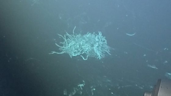
The central California coast reveals a fascinating geological feature: a vast region of pockmarked seafloor, measuring about 500 square miles. For decades, scientists believed these formations were caused by methane bubbles escaping from the ocean floor. However, recent studies conducted on 2025-05-13 03:48:00 have challenged this long-held assumption, uncovering a more complex story behind these intriguing depressions.
- Central California coast has unique pockmarked seafloor.
- Methane seepage theory challenged by new findings.
- Advanced robotics used for detailed mapping.
- Sediment gravity flows shape pockmark features.
- Offshore wind farm planning benefits from research.
- Many questions about pockmark origins remain.
Researchers utilized advanced underwater robots and sensors to map the seafloor with remarkable precision. They discovered that the pockmarks, averaging 656 feet across, are not merely remnants of gas seepage, but rather the result of ancient sediment flows that have shaped the landscape over thousands of years. This new understanding is crucial, especially as plans for offshore wind farms in the area raise questions about the stability of turbine foundations.
This revelation opens up intriguing questions about the dynamics of the seafloor. How did these pockmarks form initially? Are they remnants of ancient geological events or the result of ongoing sedimentary processes? Key insights include:
- The pockmarks are nearly perfectly spaced, suggesting active geological forces.
- Advanced mapping techniques revealed layers of sediment rather than gas pockets.
- Understanding these formations is vital for future offshore infrastructure planning.
As researchers continue to explore these underwater landscapes, they pave the way for safer and more effective renewable energy solutions. The ongoing investigation into the seafloor’s history and processes will undoubtedly yield valuable insights for both science and sustainable development.