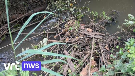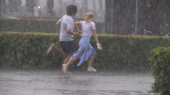
Belgium’s weather forecast signals a mix of showers and thunderstorms, with particular intensity expected south of the Samber and Maas rivers. According to the Royal Meteorological Institute (KMI), these slow-moving storms could bring heavy rainfall, especially in the provinces of Namur and Liège, creating challenging conditions for residents today, 2025-07-25 01:24:00.
- Expect afternoon thunderstorms, especially south of Samber
- Report storm or water damage via www.1722.be
- Friday brings clouds and showers from northwest
- Saturday features increasing clouds, scattered inland showers
- Sunday sees rain moving from coast inland
- Monday remains unsettled with coastal showers
As the afternoon unfolds, temperatures will generally hover between 22 and 25 degrees Celsius, but the risk of localized flooding due to intense downpours is a concern. How should Belgians prepare for this unsettled weather? And what does the outlook for the coming days suggest?
Understanding the evolving weather pattern is crucial for safety and planning. Here’s a concise update on what to expect and how to respond.
Is this weather pattern typical for this time of year? While summer storms are not unusual, the intensity and slow movement raise concerns about localized flooding and damage. Residents should stay alert and consider the following:
- Thunderstorms will ease from the northwest by Friday, with clearer skies along the coast.
- Saturday brings more cloud cover and scattered showers inland, but drier conditions in the west.
- Sunday and Monday will see variable weather, with rain shifting from the coast to the Ardennes and intermittent sunshine.
- Use the e-loket or call 1722 for non-life-threatening storm assistance to avoid overwhelming emergency services.
Looking ahead, Belgians should monitor weather updates closely and plan activities with caution. Will you adjust your weekend plans to stay safe? Staying informed and responsive to official advice remains the best way to navigate this unsettled spell.